The first software to integrate structural and geological logging, using innovative modules to link and visualize structural data in 3D and in real-time right at the core shack
Our Tools
Ore.node Software
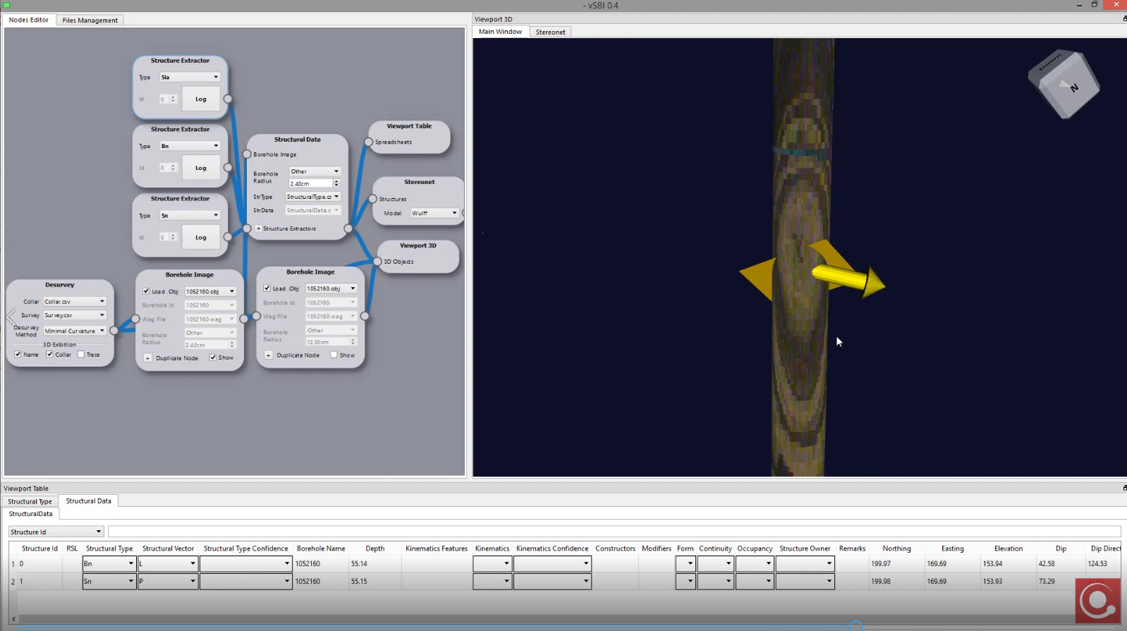
Ore.node incorporates the Vektore Structural Logging Method (developed by R. Monteiro in 2002), which allows users to extract planes and lines independently of each other, as well as relevant assignments of kinematic and asymmetric features that Ore.node recasts into its proper desurveyed space. Ore.node is a node-based, user-friendly and fast software that empowers users to quickly understand their targets while logging is taking place, allowing for faster key drilling decisions.
Get outstanding accuracy, precision and speed in structural data capture and processing at the core shack with our new AR vSTAR structural reader – a new Ore.node module.
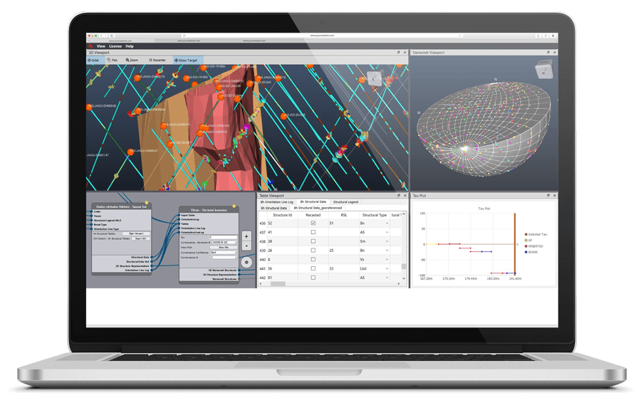
vSBI Software
vSBI© unlocks the full potential of televiewer data by enabling the extraction of linear, kinematic, and asymmetry features from images—enhancing your understanding of project architecture and mineralization geometry beyond industry standard plane collection
This implementation significantly improves the understanding of complex orebody architectures, which are later validated by underground mining, and it has been successfully applied by our team globally.
The vSBI software is currently stand-alone, however, it has been designed for easy portability into the Ore.node software. The software constructs an in-real space, to scale cylindrical wireframe of the borehole with desurveying applied. The televiewer image is draped around the desurveyed cylinder allowing the user to visualize the whole borehole image in its original form. The software provides tools to extract planes and lines directly from the 3D image-object, and users can describe kinematics and asymmetries, including way-up features if present. The structural data is stored in its internal database and wireframes of structures, 3D images and the database can be exported for additional analysis when required.
vKore 3D Scanner System
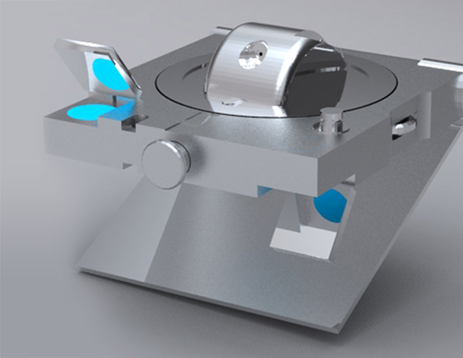
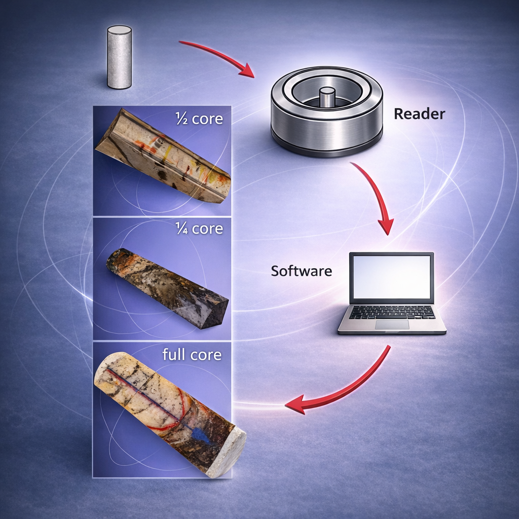
A 3D modular core scanner designed to generate a 3D virtual core library from which any structural features can be extracted. The system is composed of the vKore Reader and the vKore Software. (keep it inside the caption box)
The vKore® Reader is the first core imaging device designed to scan ¼, ½ and full core segments; it is portable, rugged, lightweight, fast and it can also be powered by car batteries for remote use. It is easily harmonized with normal geological logging workflows at the core shack. The use of the vKore Reader and Software increases efficiency and efficacy while logging and handling core at the core shack. It provides validation and auditing through record keeping and virtualization of core segments, allowing for on-site and off-site analysis and validation. It’s particularly useful for acquiring digital images from relevant core segments and it also optimizes core handling by eliminating the need for core storage. (US Patent No. 10,235,760 B2, Mar. 19, 2019)
The resultant 3D high-accuracy and high-quality digital image, the virtual core, can be digitally stored and electronically transferred off site to any location worldwide for processing lines and planes, including kinematic features and asymmetries associated with faults and folds. The virtual core and its structural features are digitally stored in a virtual core library and a database. Their spatial location, orientation and characteristics are directly extracted from within the software’s 3D viewport. This allows for the structural information to be validated and audited by experts or prospective investors, even after the core has been cut, split and pulverized for chemical analysis. The software is currently stand alone, however, the process to port it into the Ore.node software has been planned for – it will allow the vKore system to take advantage of the other facilities provided by Ore.node.
About the vKore Reader and Software Workflow
-
- Core segments (full, one-half and one-quarter) are placed inside the vKore Reader for imaging and scanning
- Images and geometrical information are directed to the vKore Software for processing and creation of the 3D virtual core
- Point Cloud, geometry adjustments and image warping creates the 3D virtual core that can be stored in a virtual core library
- Planes and lines are extracted independently of each other directly from the 3D virtual core
- Planes and lines are described and logged into vKore’s database
- Planes and lines are plotted into a fully functional 3D stereonet for visualization and analysis
- Data, images and 3D objects are exportable to popular formats for exchange and linking with other software
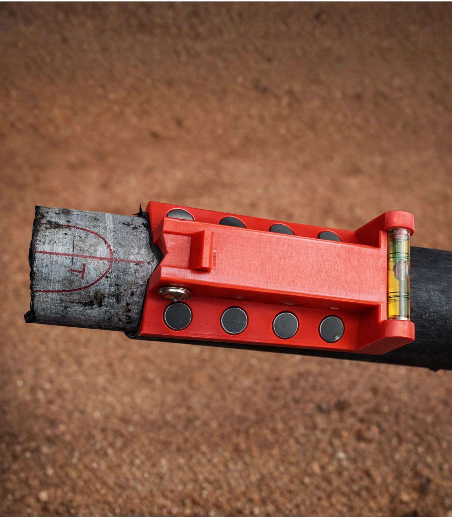
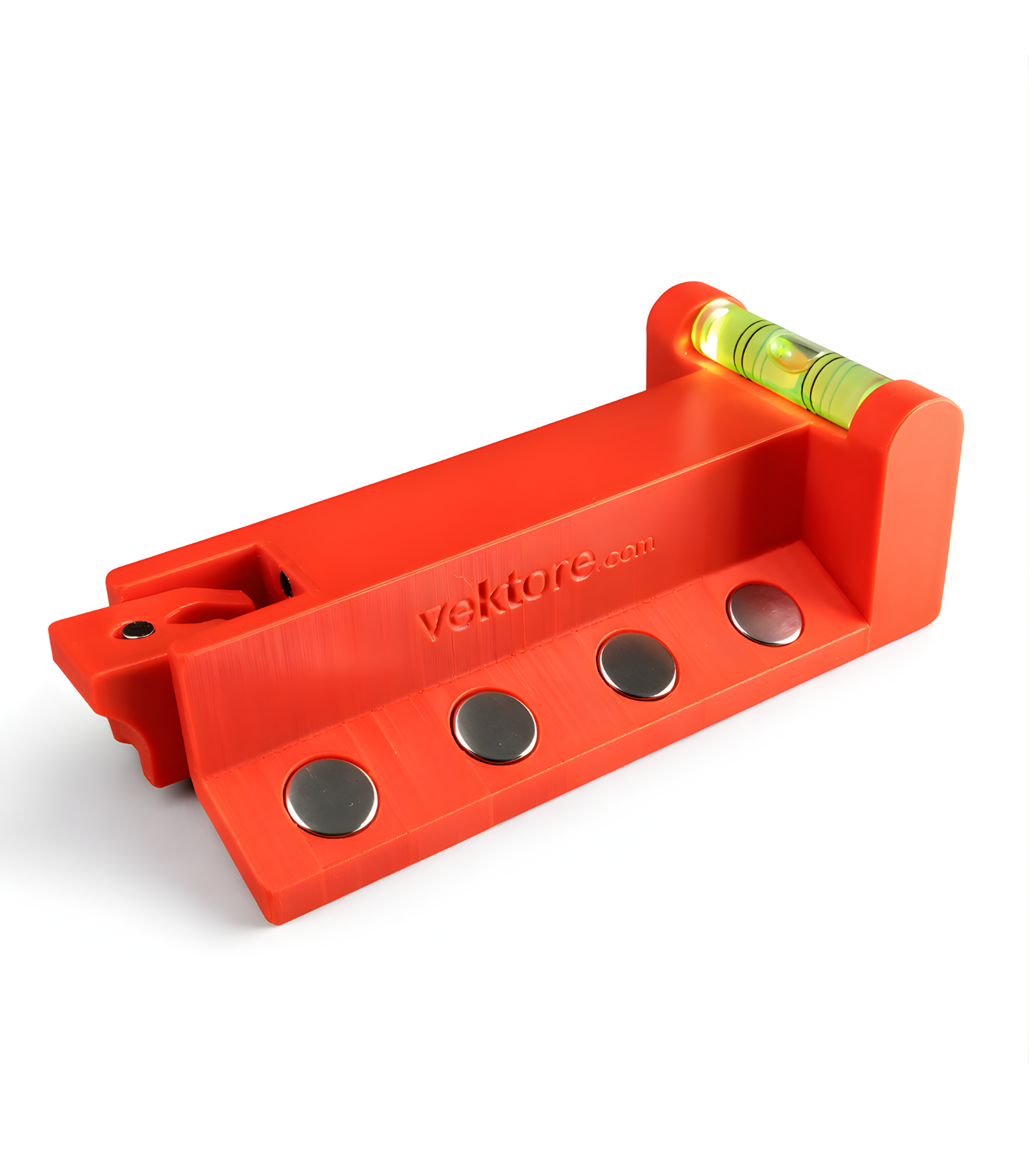
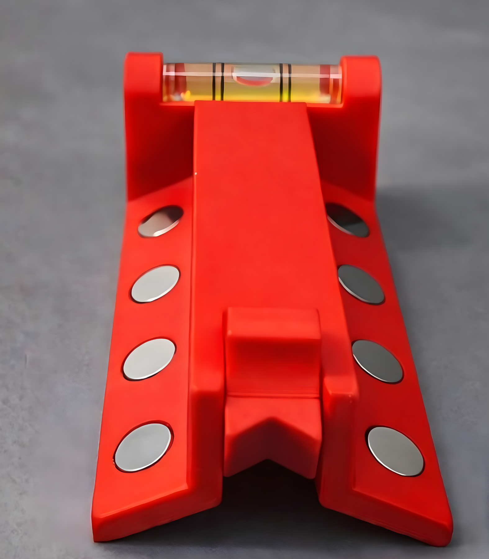
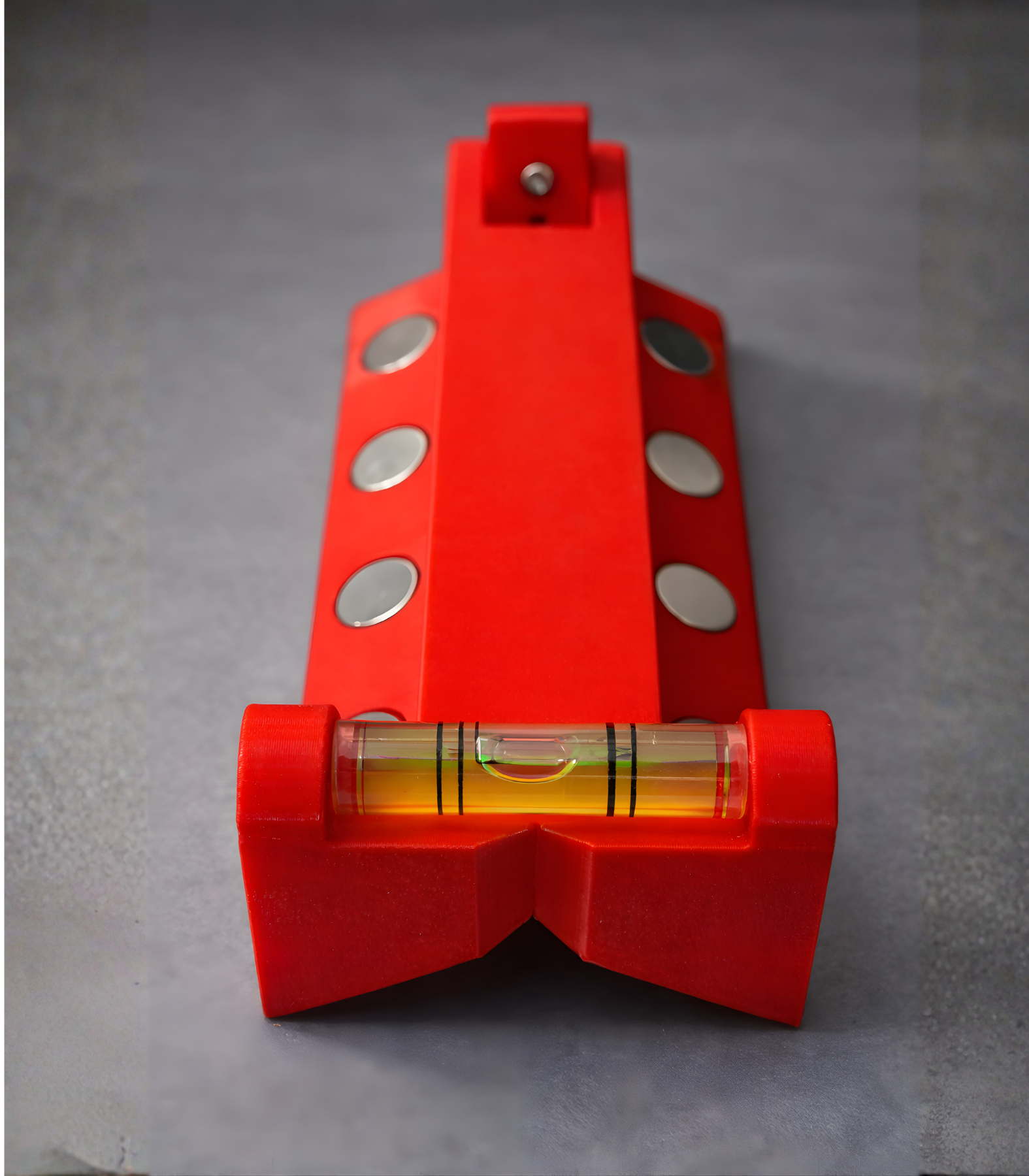
vCAT© Open-Source Core Alignment Tool
Ready to improve the accuracy of your core orientation processes? Download the vCAT (Vektore Core Alignment Tool), it’s free, open-source, and designed to improve structural data reliability in mineral exploration. Together, let’s advance best practices in core alignment.
vCAT© is an open-source core alignment tool designed to improve the accuracy of orientation mark transfer and alignment control during core handling and logging. The tool provides a simple, repeatable method to verify core orientation consistency and reduce errors that can propagate into downstream structural interpretations.
Accurate transfer of orientation marks along core runs is critical for reliable structural data collection and subsequent geological interpretation. Even small misalignments introduced during core handling, marking, cutting, or reassembly can accumulate along a run, leading to significant orientation errors when structural measurements are later integrated into 3D models. These errors can compromise the consistency of structural datasets and reduce confidence in downstream analyses and interpretations.
The vCAT tool was developed to address this challenge by enabling:
- – Reliable top-of-core and bottom-of-core (TOC/BOC) orientation mark transfer
- – Indented face marking while the core remains locked inside the core lifter
- – Rapid alignment checks between consecutive locked core runs
By introducing a simple physical control step into the logging workflow, vCAT helps improve the consistency, auditability, and overall quality of structural orientation data collected at the core shack.
vCAT© is open-source and released under the CC BY-NC-SA 4.0 license.
Commercial use requires a separate agreement with Vektore.
vCAT use includes:
-
- Verifying orientation continuity between locked core runs
-
Transferring orientation marks prior to cutting or splitting
-
Performing quick alignment checks during core handling
-
Supporting quality control and auditing of structural orientation data
ML-Compass
The ML-Compass (US Patent number 6701631; Monteiro and Laamanen, 2004 (Authors); intellectual property of Vale S.A.) was developed to overcome the problem of collecting structural data in locations where the magnetic field is distorted, where conventional magnetic compasses are rendered useless (such as with underground mines, highly magnetic rocks or ore, locations with high magnetic inclination).
This compass can be used underground and in open pit environments and was also tested in high-latitude areas. It is simple to use and results can be obtained in real time. Vale S.A. kindly allowed Vektore to use this tool while delivering services to Vektore’s clients.